|
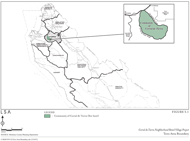
The community of Corral de Tierra lies along
Highway 68 midway between Salinas and the Monterey Peninsula.
State Route (SR) 68 stretches 20 miles between
Salinas and Pacific Grove. It is part of the DeAnza Trail, a
route that once linked all of California’s mission settlements
during the Spanish Colonial era. CalTrans had plans to turn SR
68 into a freeway in the 1950s and 1960s, but environmental
concerns stopped the expansion. As of 2006, the route carried
26,000 vehicles a day. Many of these trips are generated by
13,500 residents who now live in the Toro Park, San Benancio and
Corral de Tierra districts.
The corner of Corral de Tierra and Highway 68
is 10 miles from the City of Monterey and seven miles from the
City of Salinas. An 11-acre site at this intersection is the
only remaining site zoned for commercial development along SR
68 in the Toro Area.
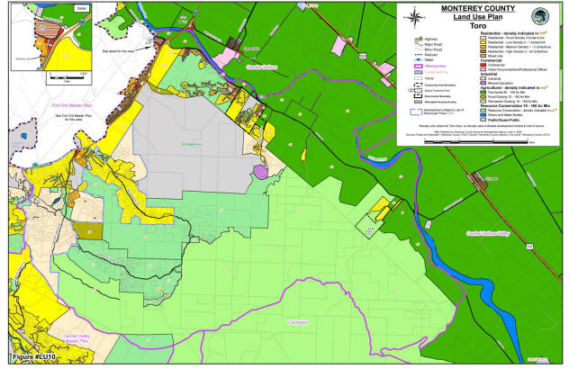
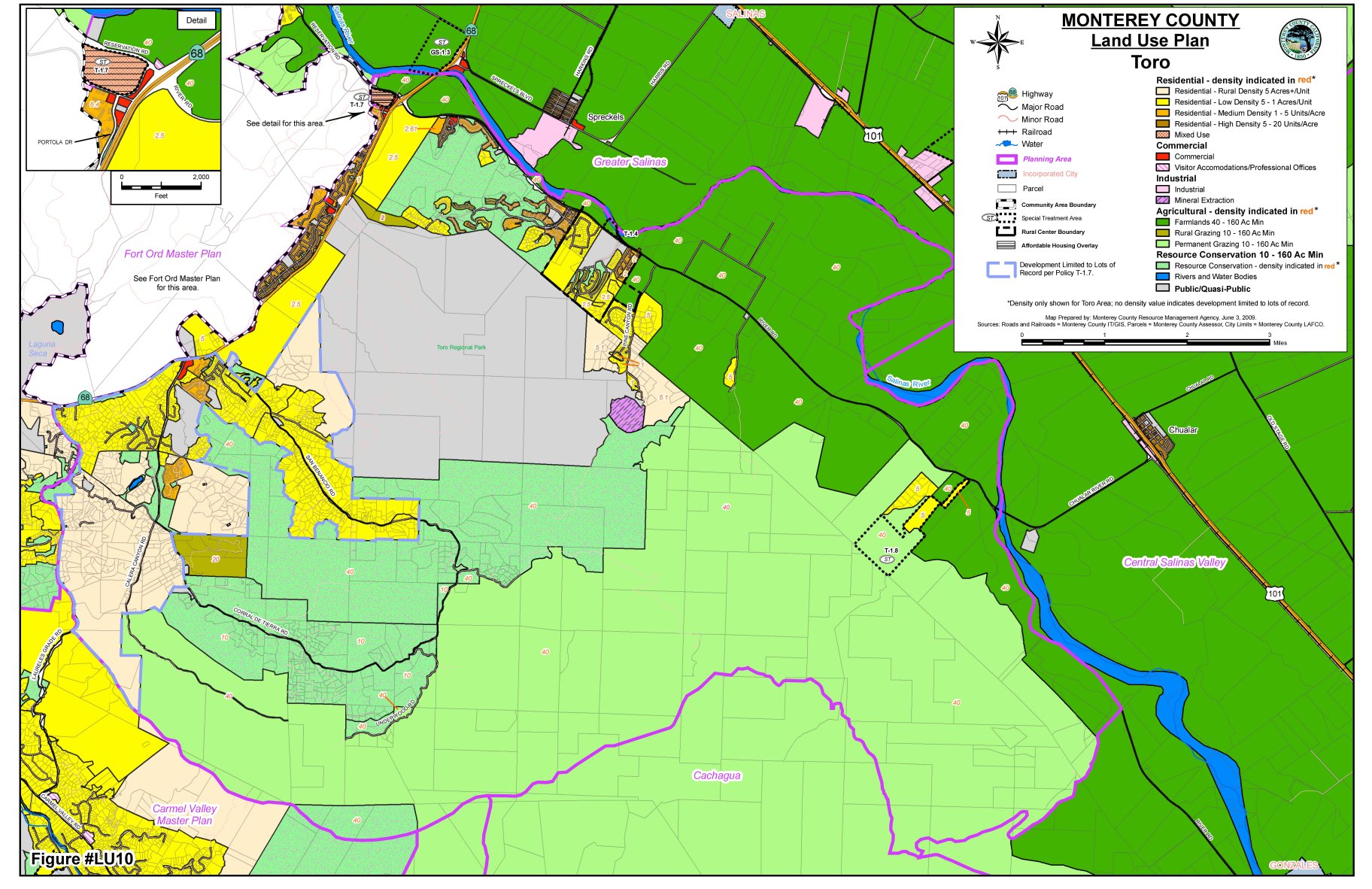
Click to enlarge
The Toro Area Land Use plan zones most of
the 74 square mile area for resource conservation, grazing, or
residential uses. The 11 acre site at the corner of Corral de
Tierra Road and Highway 68, colored in red, is the only
remaining site zoned for commercial development along SR 68 in
the Toro Area. The adjacent Ft. Ord land use plan preserves
undeveloped areas north of Highway 68 as “Habitat Management”
and “Open Space Recreation,” which essentially paints the white
area in this map as “Green” as well.
|